My wife, Helen Jones-Florio, and I co-led the first recorded source-to-sea expedition along the length of River Gambia, from its humble source in the remote highlands of Guinea, through Senegal and into The Gambia where it widens to nearly 14km and exits into the Atlantic Ocean. We teamed up with two old Gambian friends, Abdou Ndong a fisherman and Ebou Jarju a school teacher, as our river guide and translator.
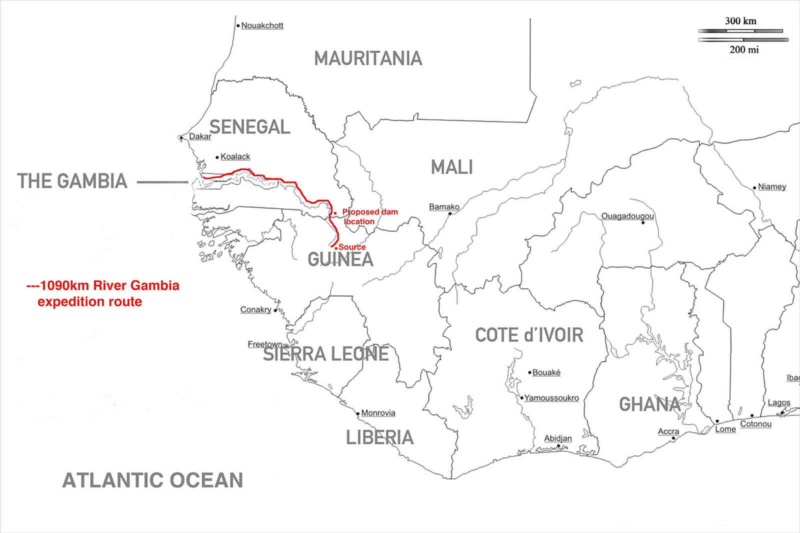
1090Km River Gambia expedition route
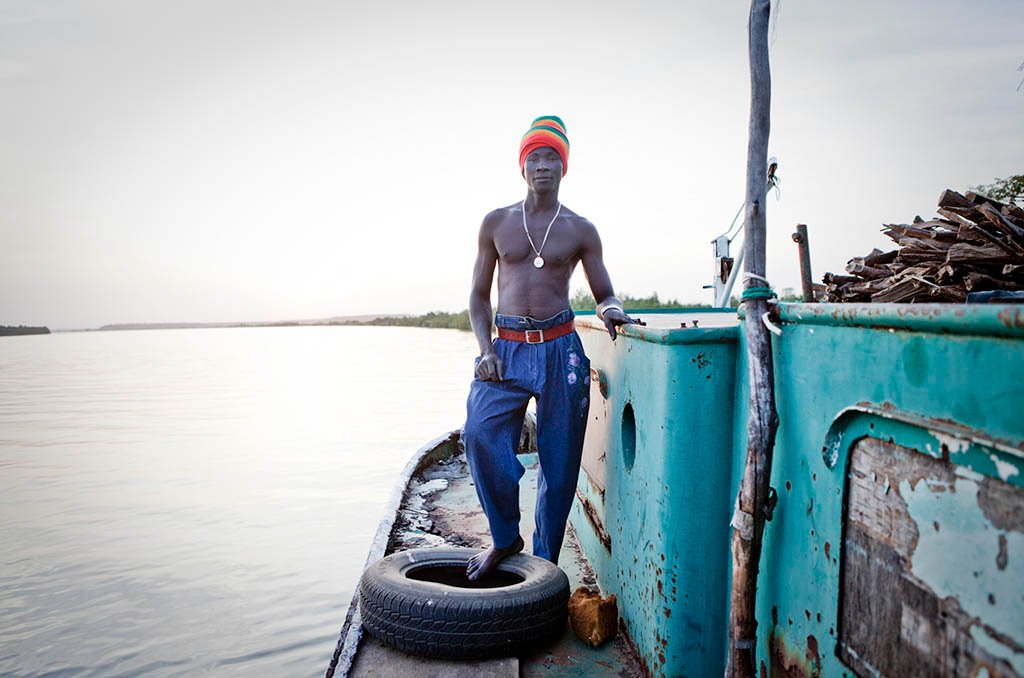
River Gambia is one of the major arteries into West Africa from the Atlantic Ocean. Penetrated in 1455 by Portuguese explorers, fought over by the French and British, and traveled up by Scottish explorer Mungo Park on both his attempts to seek the course of the River Niger. Slave traders sailed their human cargo down her for markets in the Americas, adventurers pushed far into the interior of what is modern day Senegal in search of gold, and huge barges continue to course the navigable reaches to the old Gambian colonial era towns to collect hauls of peanuts. Fishermen still throw nets from precarious narrow pirogues throughout much its course, and Guinea-Bissau refugees scour the mangroves for oysters in the brackish tributaries. Economic migrants flock to the Senegal sections of the river, busily washing the gold bearing river sand as they have done for hundreds of years.
Once we started researching for the expedition, we discovered that plans were afoot to create a hydroelectric dam on the Guinea-Senegal border. Villages would be flooded, the natural seasonal rise and fall of the river would be choked – causing a potentially devastating effect on the environment and the people. The idea of making the journey became a matter of urgency; so as to create a modern day account of the communities that live along the banks of one of Africa’s last major free-flowing rivers, before irreparable damage was done.
The expedition took two months to cover the 1044km from source-to-sea

The source of the River Gambia emerges from under a rock in the Fouta Djallon highlands of Guinea. From this point the river meanders for 1130km through Guinea, Senegal and The Republic of The Gambia. Just before entering the Atlantic Ocean this small pool has grown to over 14km wide.
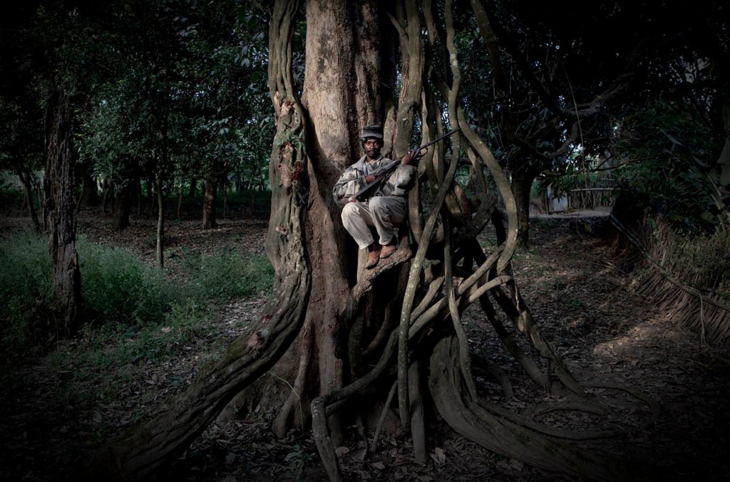
Amadou Djallow, a tailor by day and hunter by night . Photographed in his home village, Horé Dimma where the source of River Gambia is located.
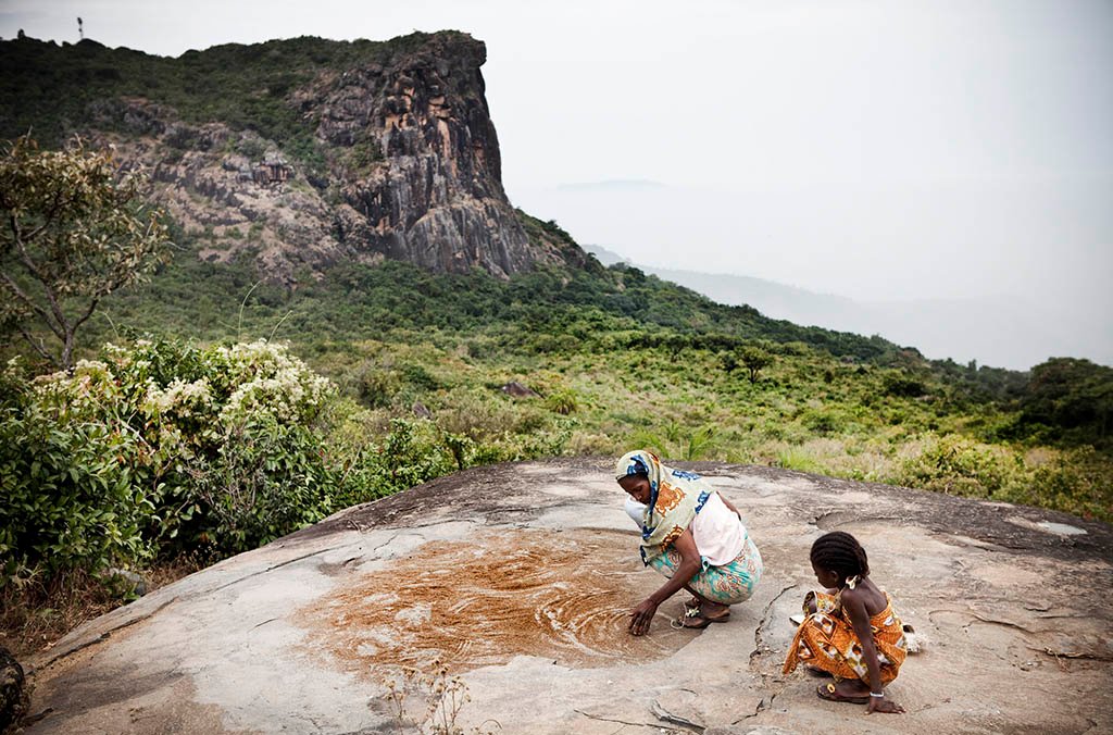
A mother and daughter lay cous out to dry on the rocks in the Fouta Djallon highlands of Guinea – source of the Niger, Senegal and Gambia river. In the background is the Dame de Mali, a rock formation in the profile of a woman – purportedly turned to stone for infidelity.
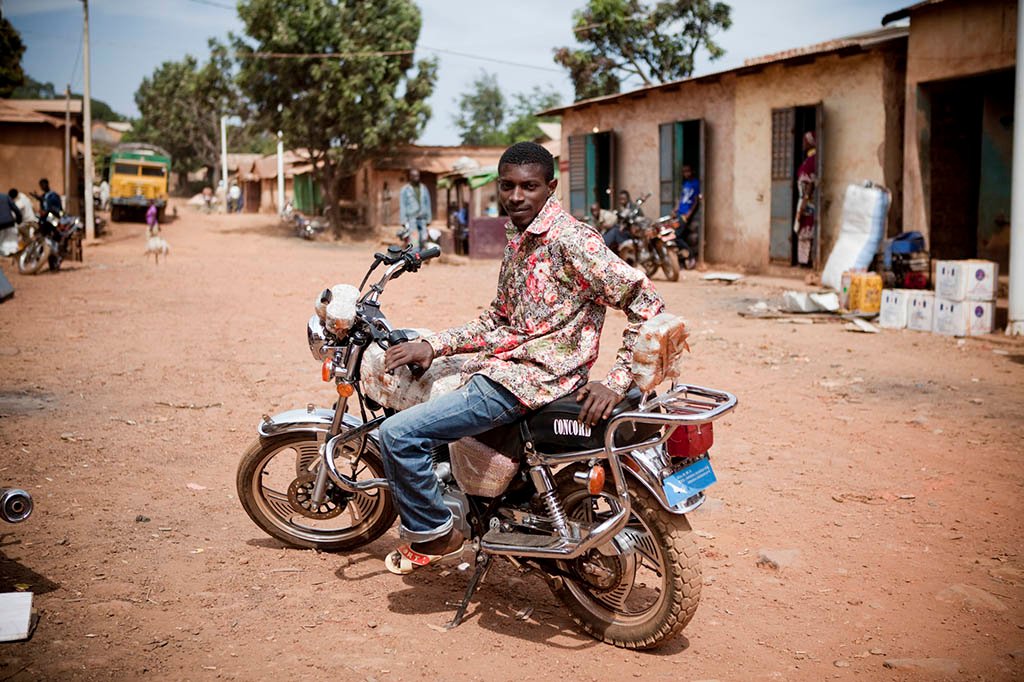
Mousa Djallow Motorcycle taxis rider. Djallow bringings customers up and down through the Fouta Djallon highlands of Guinea from the source of River Gambia. He makes the arduous 60km – 10 hours ride down the rock-strewn paths of the Fouta Djallon to Senegal, up to three times a week. The Fouta Djallon has the reputation of having some of the worst roads in the world
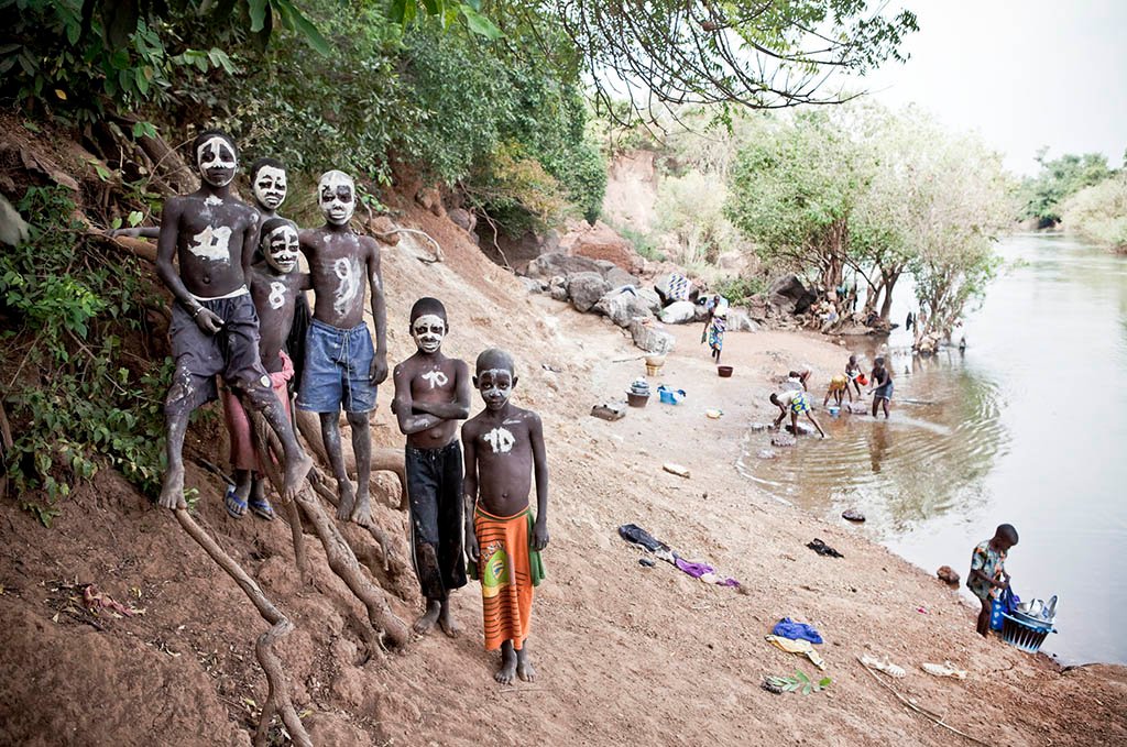
Young boys pose for a portrait on the banks of River Gambia in Senegal. They said they had painted their faces like skulls for their own amusement.
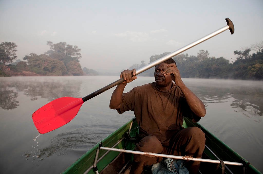
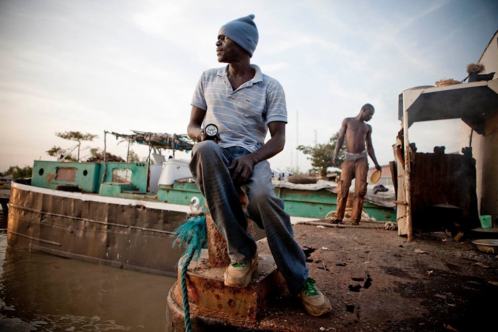
Expedition team member Adbou Ndong keeps an eye out for hippos in Senegal.
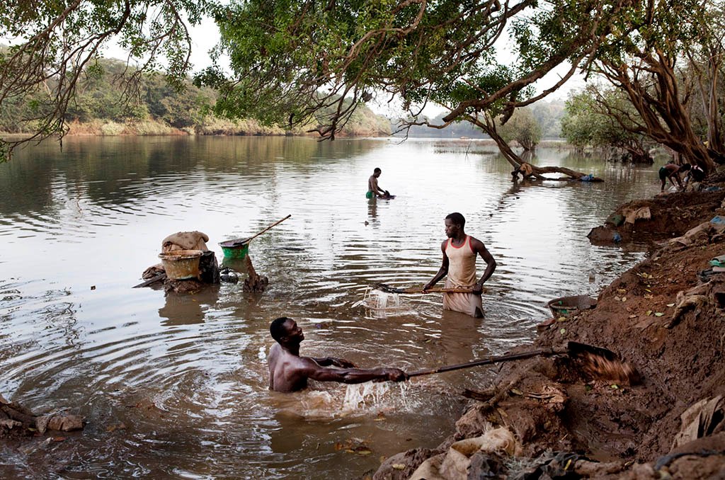
Gold mining along the River Gambia as it flows through Southern Senegal draws economic migrants from all over West Africa. The gold bearing sand is filtered and then mixed with mercury to draw the gold out.
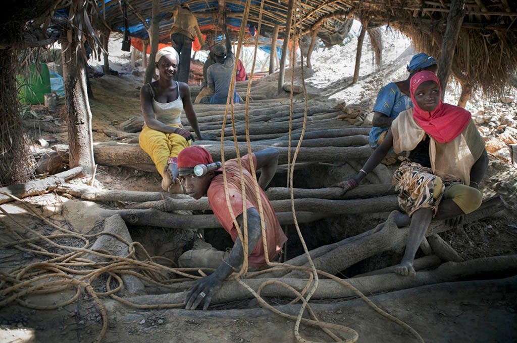
A Senegalese gold miner appears from the small shaft from where he is extracting gold bearing rocks.
A gold mine worker relaxes after a shift at an artisanal mine in Senegal on the banks of the River Gambia.
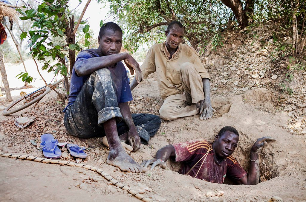
A Senegalese gold miner appears from the small shaft from where he is extracting gold bearing rocks. His two partners help haul the loaded bucket up to the surface. Mines shafts often collapse and many people are killed each year in their pursuit.
A young mine worker waits to be ferried across the River Gambia after working with his father at one of eastern Senegal’s artisanal gold mines.
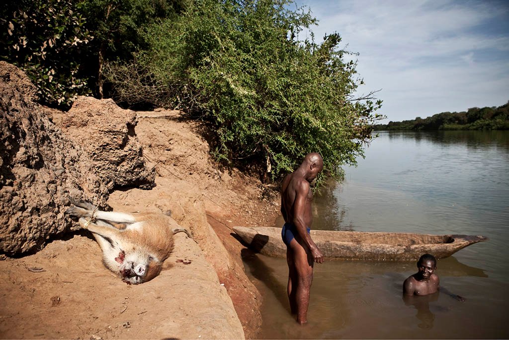
Hunters from the Basari tribe, Senegal with a patas monkey they shot for their Christmas feast
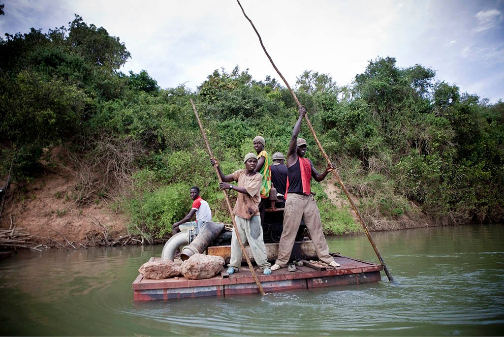
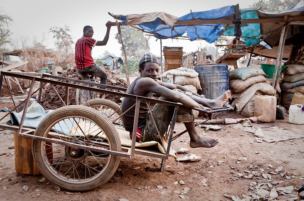
A team punt a raft carrying a water pump that will be used to irrigate banana plantations that flank the river banks in Senegal
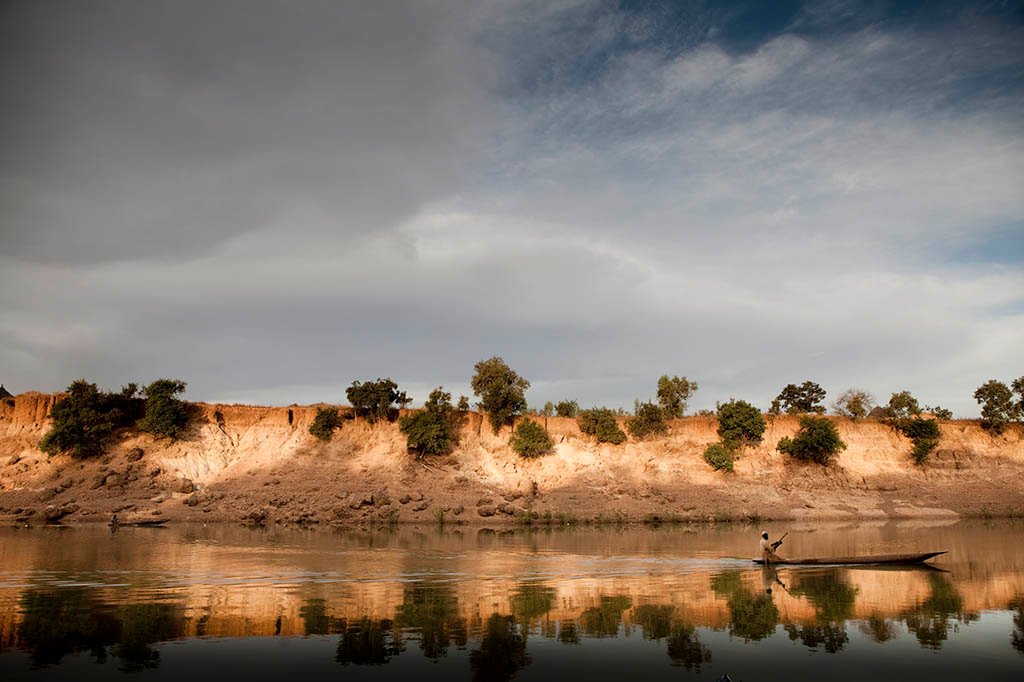
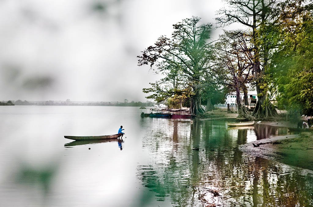
A fisherman paddles past the sandstone banks of River Gambia at Goloumbou, Senegal. The water level in the rainy season will reach close to the top of the banks
A fisherman on River Gambia at Goloumbou, Senegal. The water level in the rainy season will reach close to the top of the banks
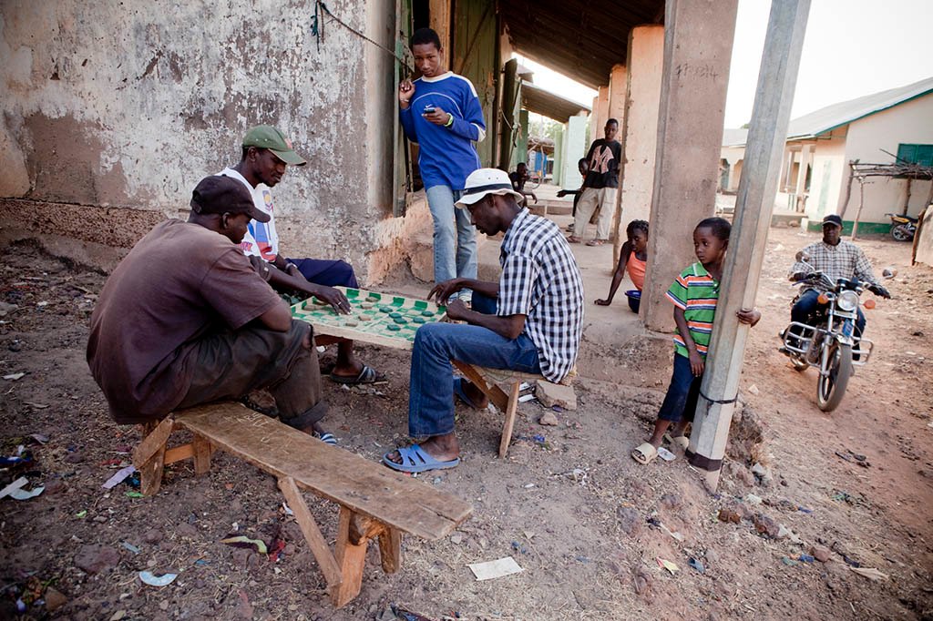
Men play draughts in the riverside village of Fatoto in the Upper River Region of the Gambia
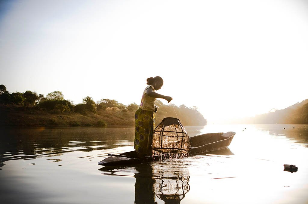
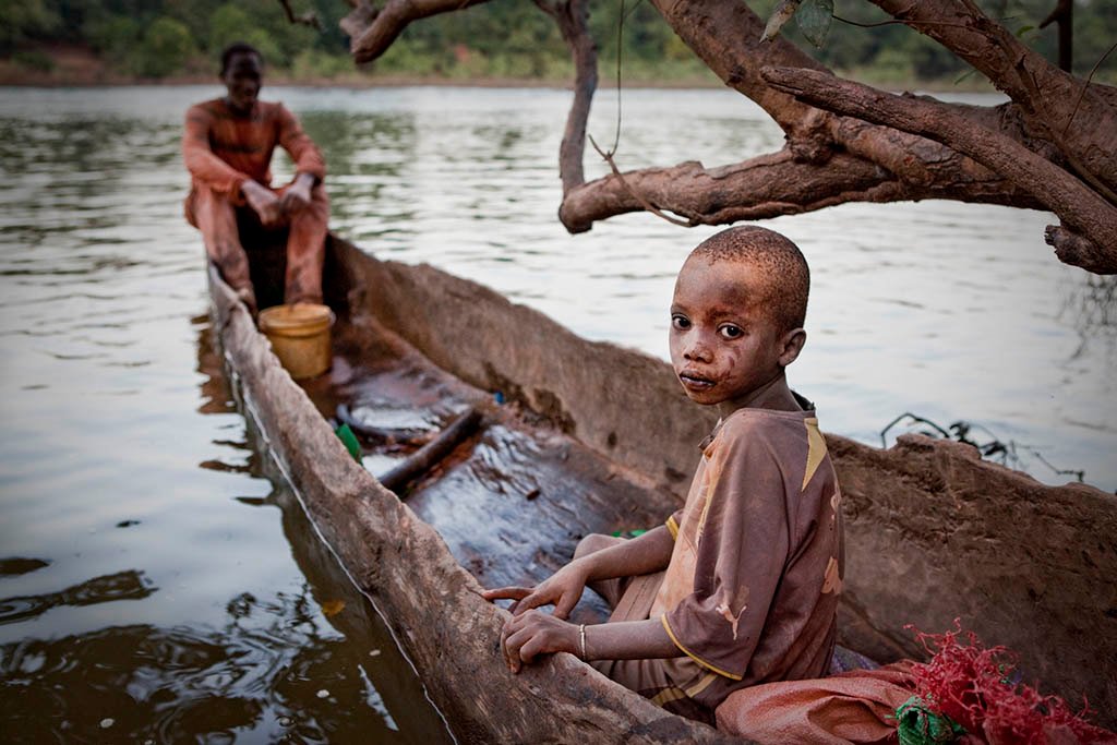
A migrant fisherwoman from Mali checks her fish traps near Fatoto, The Gambia
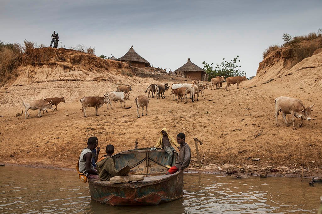
A community ferry called a barra, transports boys to the north bank of River Gambia at the village of Fatta Tenda
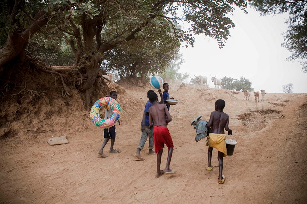
Boys head home after swimming in River Gambia at Fatta Tenda village, Gambia
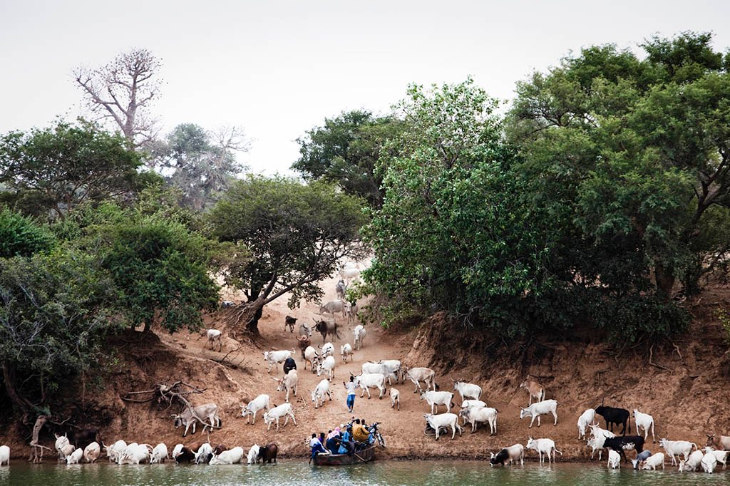
A small ferry called a barra lands on the south bank of River Gambia at Fatta Tenda in eastern Gambia surrounded by cattle owned by Fula pastoralists
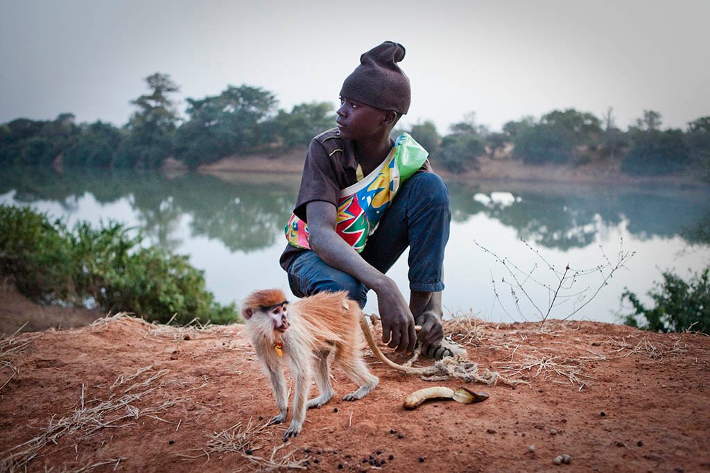
Musa with a rescued patas monkey on the banks of River Gambia at Fatta Tenda
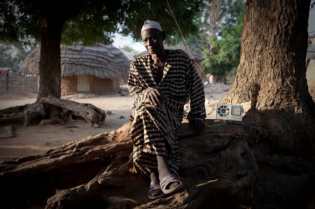
Alkalo of Diagabu Tenda, The Gambia
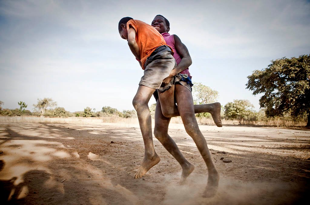
Young boys wrestling in a traditional Gambian style in the riverside village of Karantaba. Karantaba was where Scottish explorer, Mungo Park, set out from for two of his epic journeys in search of the Niger river over 200 years ago
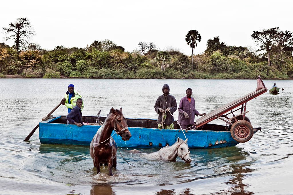
Fula men swimming their horses across River Gambia at Karantaba Tenda on their way to sell their crop of peanuts.
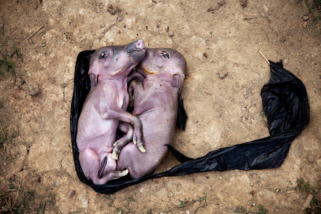
Unborn pigs taken from the stomach of a hunted bush pig in Bansang, the Gambia
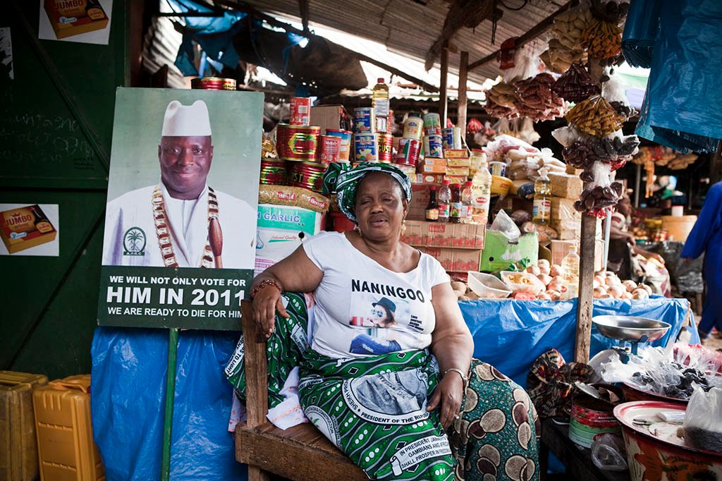
A supporter of Yahya Jammeh who ruled the Gambia from 1994-2017
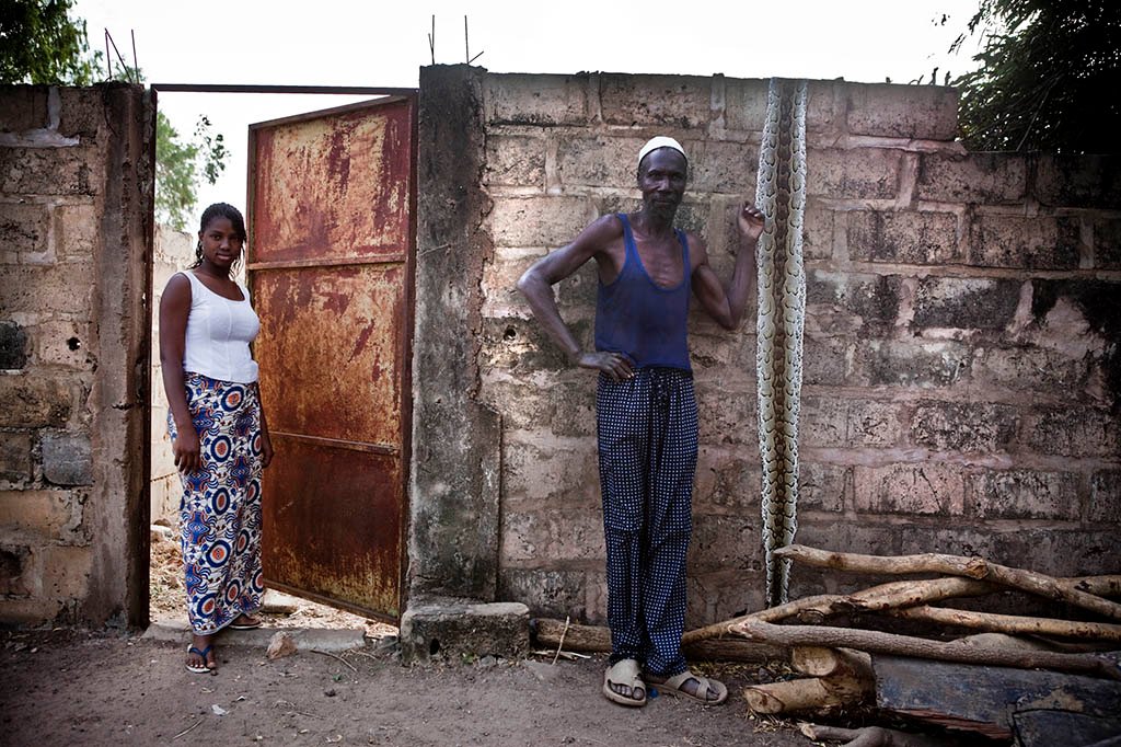
A fisherman poses with the skin of a python he caught in his net. Bansang, the Gambia
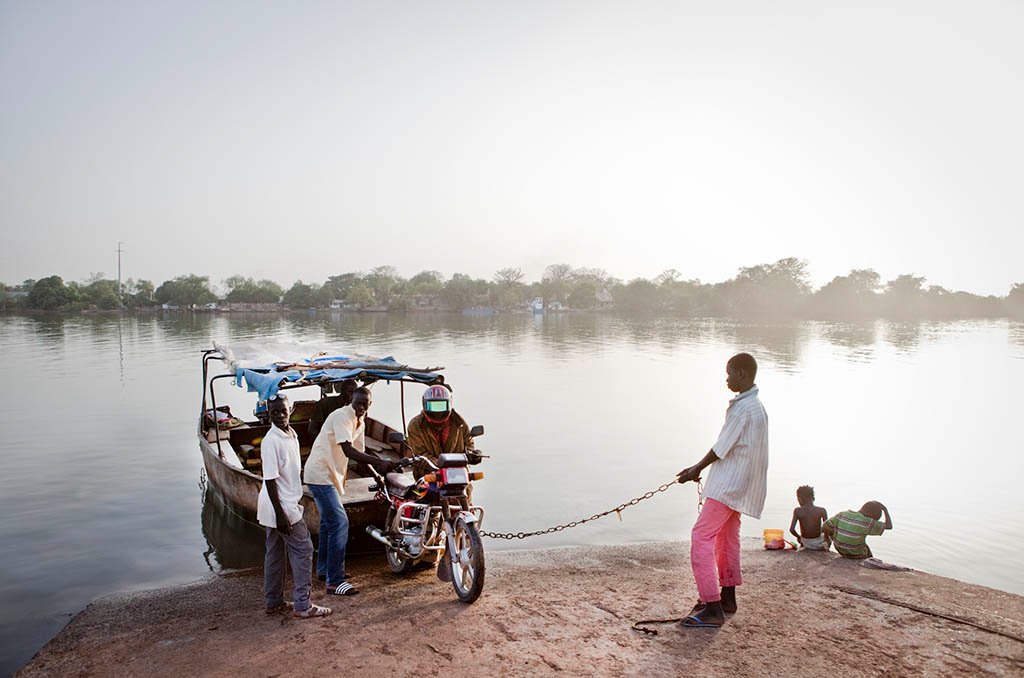
Small metal ferries, called ‘barras’ are the main way to cross the The River Gambia in the up-country regions of The Republic of The Gambia. Some ‘barras’ are motorized, but most are rowed across with a single paddle attached to the stern.
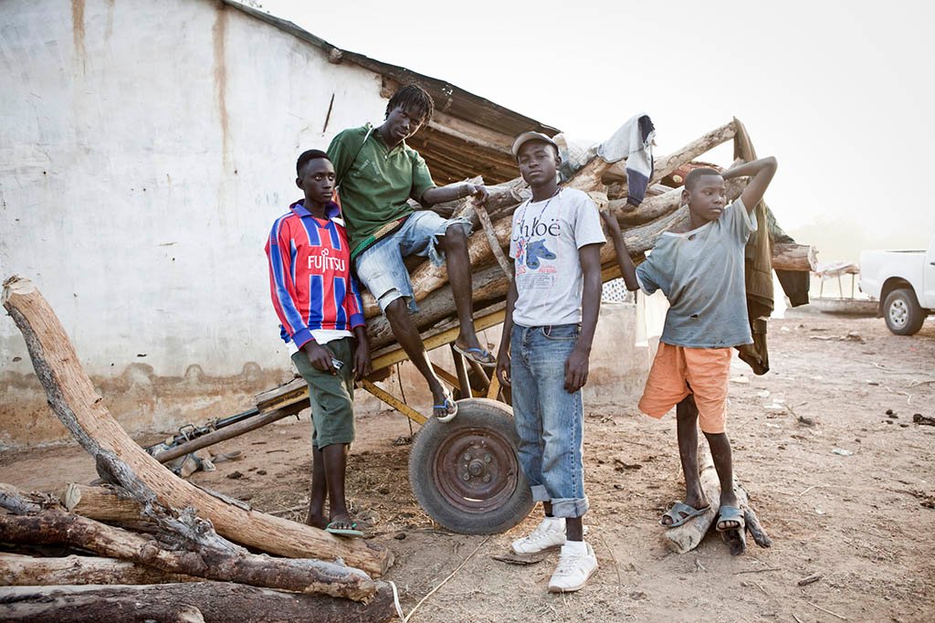
A group of boys with a haul of firewood to sell to a local bakery, despite laws against cutting down live trees. The boys said they were doing this because of lack of regular employment, and did not want to follow thousands of other young Gambians who had taken ‘the back-way’ to Europe
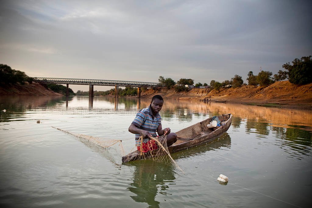
At Kuntuar wharf, The Gambia, Samba, a 12 year old boy, whose family had migrated from Senegal laying his nets, before heading to a Koranic school to study. In the evening he would return to check his nets, selling part of his catch to local fish-dealers to pay for his studies.
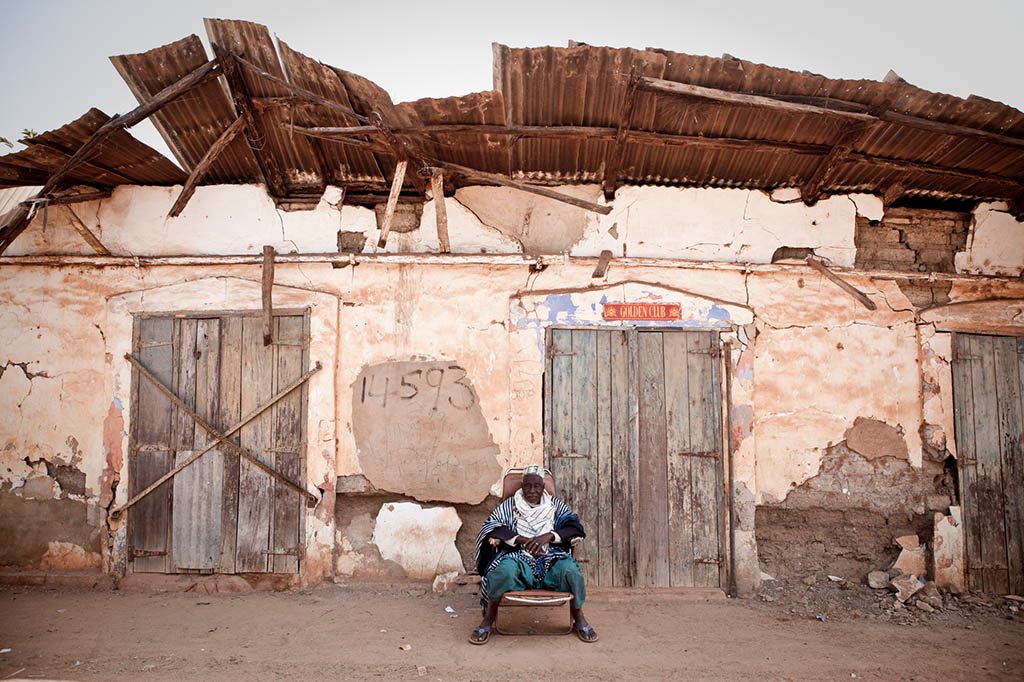
Momadou Camara, a village elder outside the facade of an old colonial era warehouse in the riverside town of Kuntaur. Kuntaur was until the 1980’s a prosperous town, but with the demise of the peanut trade in the area, and the relocation of a weekly regional market to Wassu, the town has fallen derelict in parts
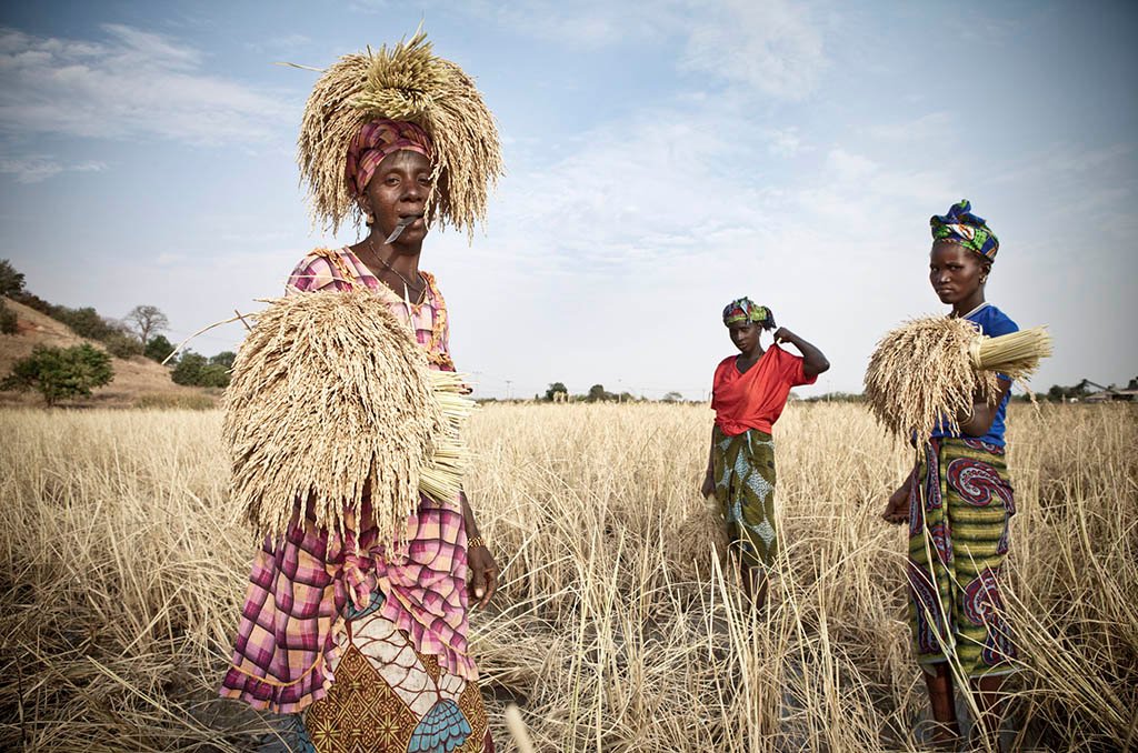
Ladies from the Santa Yalla kaffo – a collective that harvests rice for a landowner near River Gambia at Kaur. The earn 30 dalasis a day – 80 US cents
Captain Betran Jatta, one of the last few remaining full time sailors on the River Gambia, sits aboard his tugboat waiting for the cargo of peanuts to be loaded onto the 100 tonne barges that he will pull down river to the capital Banjul for processing.
Lopiz Jarju, one of the few full-time sailors still working on River Gambia. He works for the Gambia Groundnut Corporation on one of their tugboats that pulls barges with 100 tonne loads of peanuts from upcountry loading centers on the banks of River Gambia to a processing plant where the river meets the Atlantic ocean at the capital, Banjul.
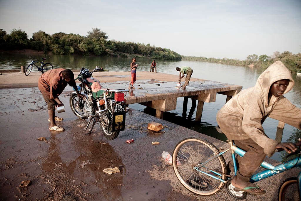
Washing bikes at Basse, the Gambia
Fishermans wharf at Balingo, the Gambia
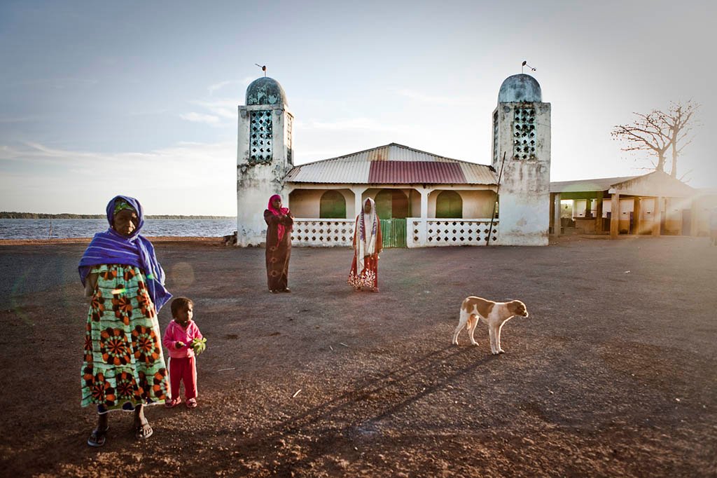
Women and a child in the early morning light in the Gambian riverside village of Tendaba meet and greet neighbors in front of the village mosque
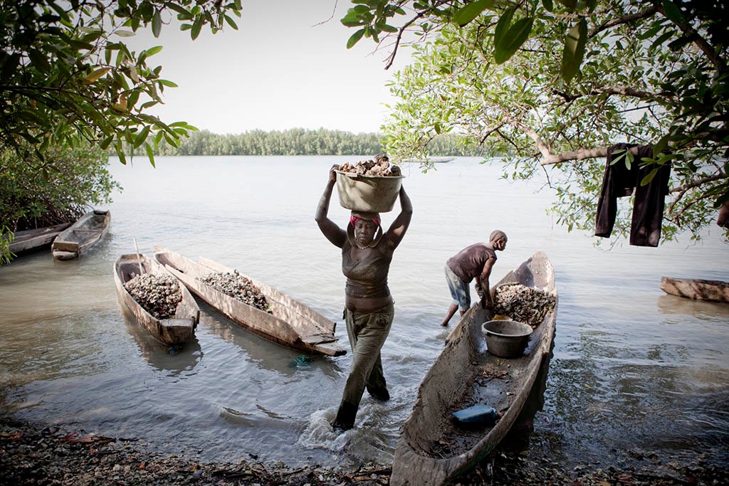
Female migrants from Guinea Bissau work along the shores of a tributary of River Gambia, in The Gambia, collecting oysters that hang from the mangrove
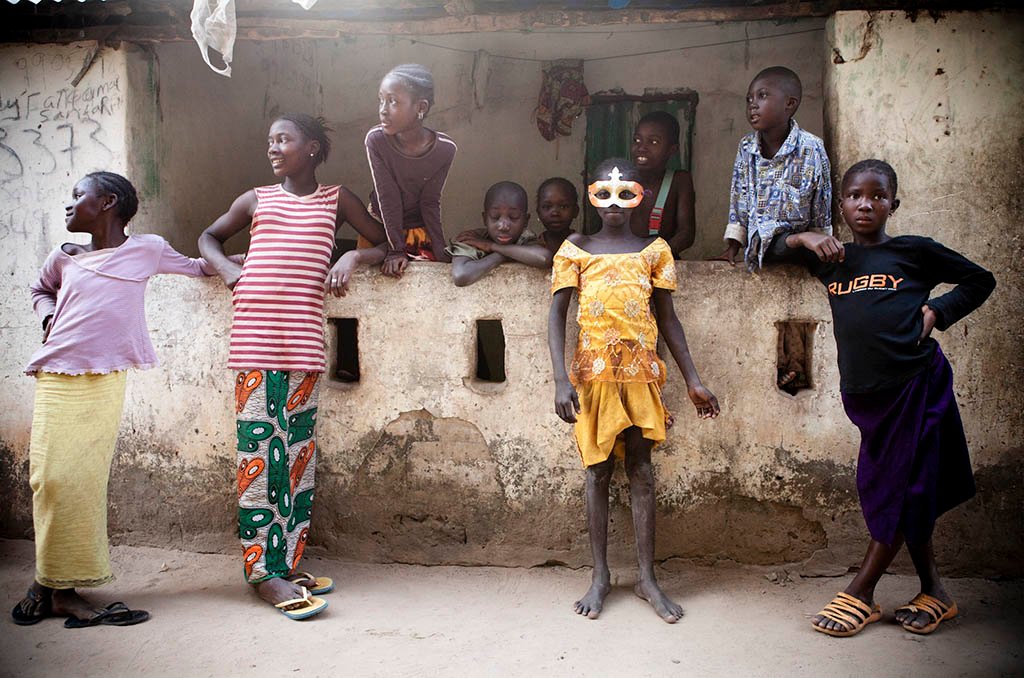
A young girl plays ‘dress-up’ with a Mardi Gras style masque in the village of Mandinari, a populous settlement on a ‘bolon’ (tributary) off the River Gambia.
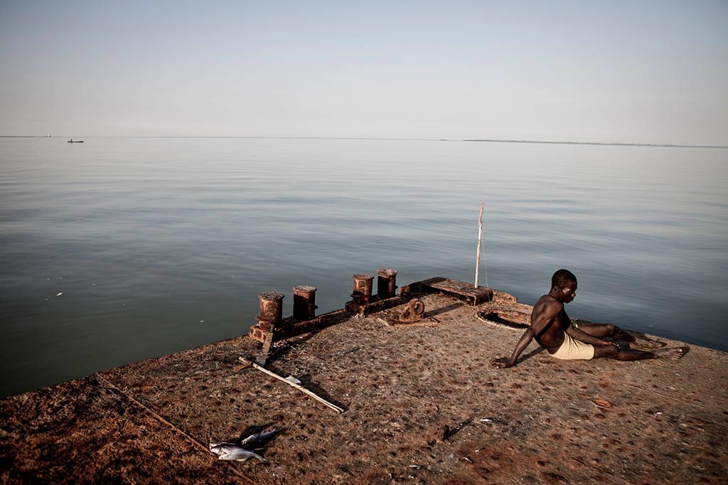
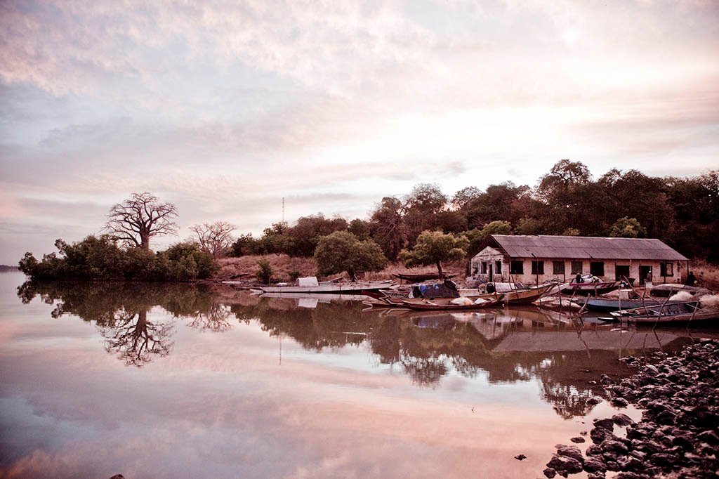
A jetty at the Gambian village, Bonto.
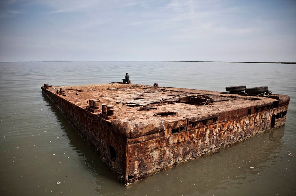
A watchman relaxes on a jetty at the Gambian village, Bonto. Bonto became infamous in 2009 when a two-tonne cocaine stash, with a street value of $1bn, was discovered in a riverside warehouse next to the jetty. The street value of the haul far exceeded Gambia’s $782 million annual GDP in 2009. The river at this point is 14km wide
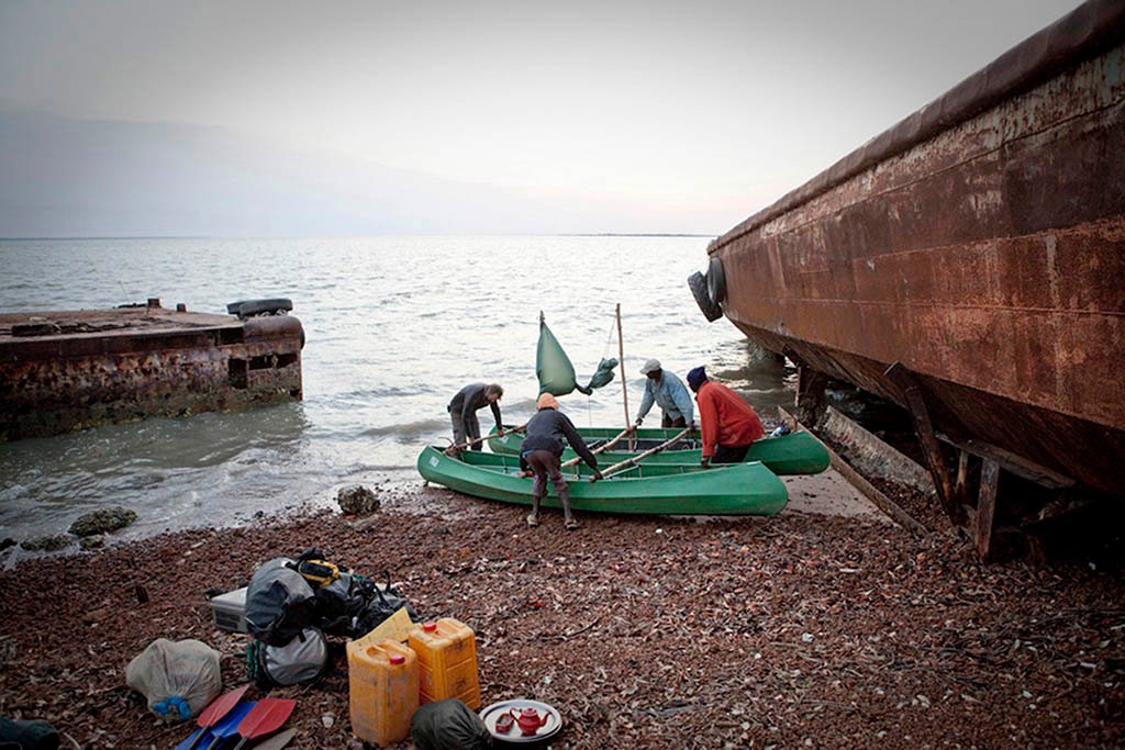
River Gambia expedition team prepare to launch ‘The Twins’ – (our two 6 meter canoes lashed together into a catamaran) into river Gambia on the penultimate day of our 1030km expedition
Jason Florio works closely with his wife, Helen Jones-Florio and together they completed the first recorded circumnavigation of The Gambia by foot a 930km expedition, to create a modern-day photographic record of traditional leaders; which inspired them explore the region further and make the River Gambia Expedition. They are currently working on a multi-year project documenting the victims and resisters of the former Gambian dictatorship.
Explore more of Jason’s work at his website www.floriophoto.com, and prints at www.helenjonesflorio.com connect on IG @jasonflorio & @floriotravels.
3 Comments
Thank you so much for sharing. this is a very interesting outlook of River Gambia. More interestingly is the Economic activities associated with The river.
[…] 30, 2019Uncategorizedjason florio SAFARI254 – The source of the River Gambia, Fouta Djallon Highlands, Guinea-Conakry ©Jason […]
Dear Jason Florio,
I just read your article on the source of the River Gambia and I found it very interesting considering the flooding that is affecting my home town of Basse. Based on your article, i am under the impression that the hydroelectric dam on the Guinea-Senegal border may be the cause of the flooding.
Do you have additional information on the relationship between activities at Fouta Djallon and flooding in Basse, Gambia?